This Space Available
By Emily Carney
This weekend, many of us on the United States’ eastern coast made preparations for Hurricane Dorian, the devastating tropical cyclone that has been parked over the Bahamas for close to an entire day. While Dorian’s slow speed and reluctance to turn away from Florida’s east coast have been the butt of many memes and Facebook jibes, current meteorological satellites such as GOES-16, along with ground-based radar, have provided incredible, often stunning visual data related to the historic storm. If these technologies hadn’t been developed, early hurricane warnings in place – so common to Florida and its surrounding landmasses – wouldn’t exist as we know them today.
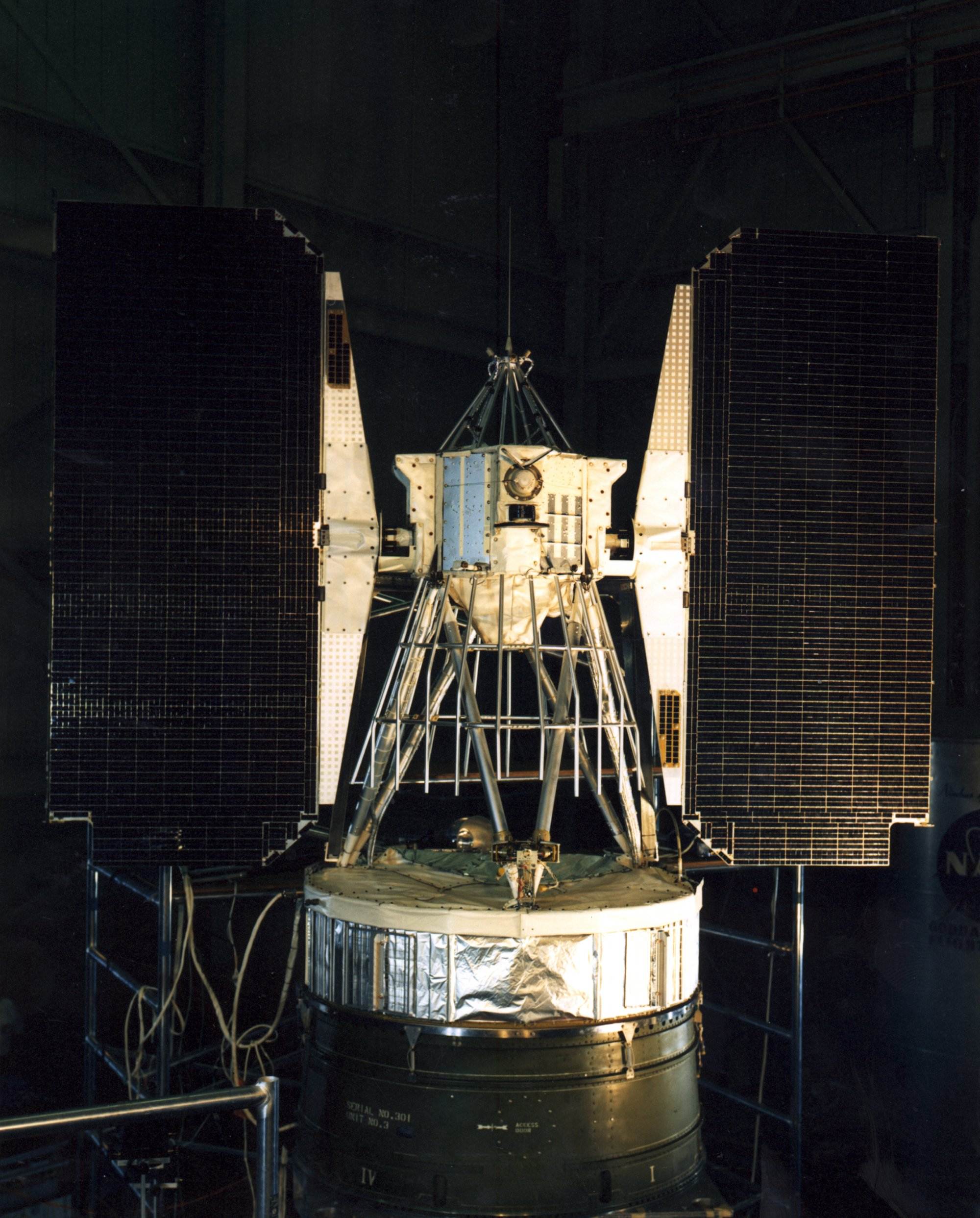
How did this happen? Enter the Nimbus program. While technologically they are many miles apart, the aforementioned satellite’s heritage owes greatly to the Nimbus program; between 1964 and 1978, seven Nimbus satellites were successfully launched, ushering in an era of many firsts – most notably, according to NASA, the program was the “first to provide daylight and night-time pictures of intense hurricane clouds viewed from space, which initiated the use of satellite technology to provide hurricane warnings.” (One Nimbus satellite was lost in a launch failure on May 18, 1968; an article about this loss is linked here.)
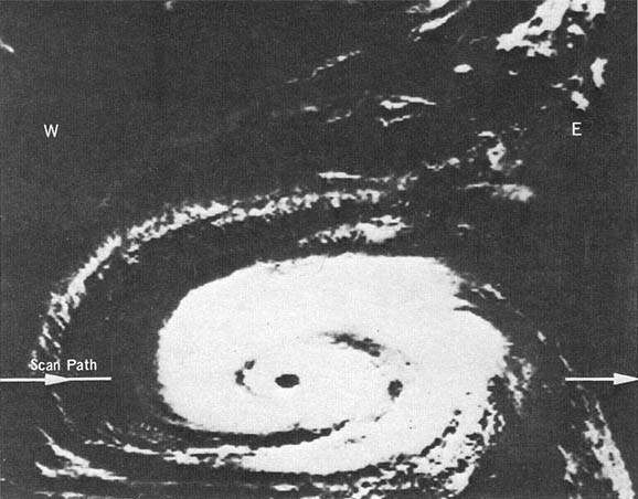
While weather radar did exist in the early 1960s, it was still somewhat rudimentary. While the first Nimbus satellite had a short operational existence of less than one month, shortly before it failed on September 22, 1964, it sent back images of Hurricane Gladys at day (via television) and at night (via infrared imaging). While this kind of imagery may seem unexciting today, at the time this proved to be a game-changer in how meteorologists viewed and tracked these types of storms. During an era where spaceflight heroics performed by space-suited men were being championed all over the pages of LIFE and Time, and humans began looking out from the confines of Earth’s gravity, Nimbus 1 and its descendants quietly pioneered the field of looking at our own planet from space. Both accomplishments are just as noble.
Another technology begun by Nimbus, according to the space agency, “[demonstrated] the first technology that allowed satellites to track movements of people, animals and items on Earth.” This early use of GPS technology, first demonstrated by Nimbus 3 launched in 1969, would aid in search-and-rescue efforts – another lifesaving benefit that underscored how spaceflight spinoffs could save scores of humans on Earth.
Does Nimbus look familiar to you? There’s a reason for that. The first three Landsat satellites, launched respectively in 1972, 1975, and 1978, utilized Nimbus’ bus (basic design). The Landsat program continues to monitor global changes; while it’s not touted as one of the most “glamorous” programs, it has been one of the most useful ones for scientists monitoring environmental trends for nearly 50 years. NASA has stated, “Nimbus paved the way for future Earth-observing systems such as Aqua, Terra, Aura, Landsat, Sea-Viewing Wide Field-of-View Sensor (SeaWiFS), Tropical Rain Measuring Mission and many more.”
Within the last 50 years, thanks to Nimbus and subsequent Earth-observing satellites, severe weather warnings have filtered down to thousands via television, radio, and now, through smartphones, undoubtedly inspiring people to quickly get to higher ground and shelter. Simply put, spaceflight saves lives.
Featured Image Credit, NASA: “Hurricane Gladys, as seen by NASA’s Nimbus 1 satellite in September 1964. Hurricane Gladys traveled over the U.S. East Coast, Bermuda and Canada.”
*****
Emily Carney is a writer, space enthusiast, and creator of the This Space Available space blog, published since 2010. In January 2019, Emily’s This Space Available blog was incorporated into the National Space Society’s blog. The content of Emily’s blog can be accessed via the This Space Available blog category.
Note: The views expressed in This Space Available are those of the author and should not be considered as representing the positions or views of the National Space Society.


3 thoughts on “Nimbus: Spaceflight For The Earth”
Thank you for sharing how the media gets their “hurricane news”
Old school satellite.
Imagine the excitement of the meteorologists of the time getting their first views from space of these monster storms that resemble a huge tornado from above. Imagine the awe they felt and maybe some new-found respect for just how complex these storms are and how little they actually knew about them. We take all these enhanced views from space for granted now. The average arm-chair weather geek like myself can use any number of free or paid weather apps on their phone or computer to study all storms, including hurricanes, do some educated analysis and take screen-shots or save pictures of radar screens, satellite imagery in daylight or infared, and read blogs by local and national meteorologists and form their own opinions. The hurricane forecasters of the Nimbus era would salivate at the imagery I can bring up on my phone and tablet. Us wannabe scientists sure have many tools to play with.